Return to the UK 2023: Margaret's Travel Log
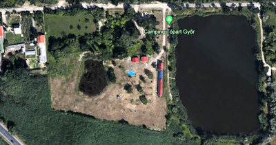 Camping Topart
Continued from Margaret's Travel Log: Romania
Updated 8 February 2024
Minis, Romania to Camping Topart, Gyor, Hungary 269 miles
Schengen Day Eighty-Two
Towards Arad on the busy rd 7, alongside tram lines and a bike path, circling several roundabouts where a new trunk road is still under construction. After 30 miles we were able to join the A1 motorway for 19 faster miles to the Romanian/Hungarian border at Nadlac/Nagylak. Here we would re-enter the Schengen Area, with 9 days left to reach the UK. At least the clocks went back one hour, giving us a fraction longer! There were the usual long lines of trucks waiting for customs checks but we had only a short queue. With our passports duly stamped at two adjacent windows, we entered Hungary and bought a Category Two 10-day (minimum) vignette for €29.
A fine new motorway took us past Szeged, joining the M5 at 86 miles towards Budapest. After lunch at modern service station at 145 miles, it was another 28 miles to the busier MO-Ring which crossed the Danube from Pest to Buda. At 190 miles we exited onto the even busier M1 for Gyor, heading northwest past Tatabanya and Tata. There were long delays before Tata, with dozens of trucks including 3 Swedish racing car transporters, while eastbound traffic flowed nicely.
Taking the third exit for Gyor at 265 miles, the SatNav led us back towards the city, then left for the signed campsite. It was an excellent find, with well-equipped kitchen and German-speaking Reception. Nice to see a cycle-touring Dutch family arrive and pitch their tents, with two young children on their own bikes and Dad towing a trailer.
Gyor, Hungary to Kur-Sport Camping Park, Eging am See, Germany (via Austria)
277 miles
Schengen Day Eighty-Three
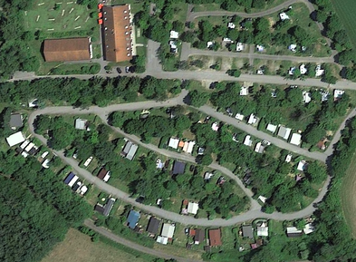 Camping Kur-Sport
Four miles back to the M1 and on to the Austrian border at 30 miles. We crossed at Nickelsdorf with no formalities and bought a (minimum) 10-day Austrian vignette sticker at the next services for €10. The A4 motorway continued almost to Vienna, skirting the south side of the capital on the busy S1, to join A21 and then A1 towards St Pölten and Linz. Despite plenty of trucks and some roadworks, the traffic kept moving. After Linz it was A25, then A8 towards Passau.
At 246 miles we crossed the River Inn, the Austrian/German frontier, into Bavaria. Continuing north on A3, bypassing Passau, we crossed the Danube at 261 miles, then turned off 10 miles later for a 6-mile climb to Eging am See. Eging is home to a Western Theme Park (Cowboys & Indians!) though we didn’t see it, intent on finding the campsite: a large level grassy site with an expensive restaurant that we didn’t use. It had been a long hot day’s drive on the motorways of three countries.
At 246 miles we crossed the River Inn, the Austrian/German frontier, into Bavaria. Continuing north on A3, bypassing Passau, we crossed the Danube at 261 miles, then turned off 10 miles later for a 6-mile climb to Eging am See. Eging is home to a Western Theme Park (Cowboys & Indians!) though we didn’t see it, intent on finding the campsite: a large level grassy site with an expensive restaurant that we didn’t use. It had been a long hot day’s drive on the motorways of three countries.
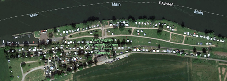 Camping Wertheim-Bettingen
Eging am See to Camping Wertheim-Bettingen, Wertheim, Germany 215 miles
Schengen Day Eighty-Four
Hot again on the day of the Summer Solstice. Back to the A3, pausing to shop at Lidl in Eging on the way down. The A3 took us all the way to exit 66 for Wertheim, with a lunch break at 166 miles in a busy rest area. It was a slow journey, tremendously busy with trucks near Regensburg, Nuremberg and Würzburg, made worse by extensive roadworks with contraflow systems where the motorway is being widened. Signs thanking us for our patience did little to help!
Just a couple of miles from the motorway to a large and popular campsite along the bank of the Main, on the Baden-Württemberg side (the border with Bavaria running down the middle of the river). Set among the Frankish vineyards producing Frankenwein, the long-distance cycle path Mainradweg passes the camp gates, with a sign advertising Kaffee und Kuchen to tempt cyclists in. We were tempted to linger there ourselves but had set our sights on spending the last 5 Schengen days at the cycling haven of Otterlo in the Netherlands, which we duly booked.
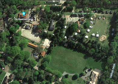 Camping Beek en Hei
Wertheim, Germany to Camping Beek en Hei, Otterlo, Netherlands 291 miles
Schengen Day Eighty-Five
Cooler after overnight rain as we returned to the everlasting 4-lane motorway A3 towards Frankfurt am Main. Heavy traffic again with hold-ups (the familiar word Stau) at numerous roadworks. After Frankfurt’s impressive airport/Hilton Hotel, with Lufthansa planes skimming low overhead, we turned north. Still on A3, which runs all the way from the Hungarian border to the Netherlands with unrelenting lines of trucks. The name on a Bulgarian lorry in front of us said it all: ‘Discordia’.
Past Limburg an der Nahe and Montabaur, turning northwest, we stopped after 166 miles for Bratwurst and chips at Siegburg services, where heavy rain set in. On into the Ruhr, Germany’s largest urban industrial area, past Leverkusen and Solingen. Traffic was gridlocked through Duisburg until Dinslaken and still busy past Emmerich am Rhein until the Dutch border at Zevenaar.
We continued on the Dutch A12 past Arnhem to exit 25, for the final 10 miles north on N310 to Otterlo, a village at the heart of the Hoge Veluwe national park and a vast network of dedicated cycle paths. The Beek en Hei (Brook and Heath) campsite reception had closed at 5 pm but we knew our way round to our favourite pitch and settled in, looking forward to meeting owners Mark and Lily again tomorrow – and ready for four days of excellent cycling,
At Camping Beek en Hei, Otterlo, Netherlands – Cycling by Numbers
The beauty of Otterlo, the reason we return, is to cycle the Fietspads (cycle paths) that radiate in all directions, fuelled by plentiful coffee and Dutch apple cake, of which we have taken many images over the years.
The Fietspads of the Netherlands form a complete network, with signposts and maps at numbered junctions. They vary in width and surface but provide well-used and safe routes around and between every town and village. See our very thorough Guide to Cycling in the Netherlands. We now enjoy four rides from Otterlo, only wishing we could stay longer.
Ride 1 - 42 km to Hoenderloo and Radio Kootwijk
On a separate cycle path alongside the main road east to Hoenderloo (10 km) for coffee and apple cake at the cycle-friendly Brunch Café, offering iced water refills and free e-bike charging. Another 10 km north on a hard-surfaced path through woods, over the heath and past an old sheep shelter to the sinister Art Deco radio transmitter built in 1918, Radio Kootwijk. Still used for film and TV productions, it is only open to pre-booked guided tours. Returned on cycle paths via ice creams and coffee in Kootwijk, sitting on the village green by the statue of a very woolly sheep, and back through Harskamp.
Ride 2 – 52 km to Lunteren and Barneveld
Quiet lanes and cycle paths west through the woods to Lunteren, a small town busy with Saturday morning shoppers, where we joined the queue for coffee and cream cakes at the bakery. Continued north to the centre of the larger town of Barneveld, past its railway station and through the suburbs to find the (badly signed) return road southeast to Otterlo, with an adjacent cycle path. On the way back we definitely needed chocolate ice sundaes in Wekerom, where it was 29°C in the shade!
At the campsite the weekly Snack Wagon appeared (5-7 pm), providing burgers with excellent Friets to round off the day. Cycling does sharpen the appetite!
Ride 3 – 48 km to Renkum and the Lower Rhine
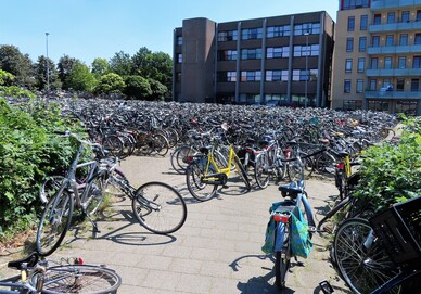
Weather even hotter as we rode the cycle paths (some concreted, some gravel) south to Renkum, pausing there for coffee and banoffee cake at the Old Post Office café. Then down to the Lower Rhine where a small ferry runs at weekends April to September and weekdays in July/August, taking cyclists across for €1.75 (pedestrians €1.50). A map showed three such ferries in the area, making a circular ride possible using two of them, though we didn’t have time for that. Back via the large town of Ede, past its railway station where we’d never seen so many cycles heaped together, and on to Otterlo via woods, heath and ice cream at the cyclists’ café 6 km short of our camp. It had been a very thirsty sweaty day.
Ride 4 – 47 km to Delerwoud and Woeste Hoeve
A little cooler with a freshening wind on another good circular route. South alongside the main road to Schaarsbergen for coffee and apple pie outside a lovely café. Then northeast via Delerwoud on sandy woodland tracks, past Woeste Hoeve, and west to Hoenderloo for a last coffee before 10 km into a head wind to Otterlo.
Otterlo, Netherlands to Strangers Holiday Park, Bradfield, UK
90 Dutch plus 10 English miles
Schengen Day Ninety (phew!)
A smooth though reluctant journey on motorways A12 and A20 to the Hook of Holland. With no delays, we were early for the 2.15 pm ‘Stena Hollandica’ to Harwich but were ushered on board the ferry at 12.15 pm, to find the daytime cabin we’d booked. Its TV was showing Matt Hancock being grilled by the long-awaited Covid enquiry, which at least ends his political career. Lunch in the self-service café (good fish, cold chips & mushy peas – the best of a very poor selection) followed by cold apple pie or dry chocolate cake, and dreadful coffee. Back to the cabin to pass the time with a film. Arrival at Harwich was at 8.15 pm, 30 minutes late due to ‘technical problems’.
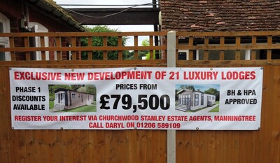
Ten miles on to what was once a pleasant campsite (the nearest to Harwich), tucked behind the Strangers Inn pub which served good meals and full English breakfasts in Bradfield village. However, it gets stranger with each visit. Now the pub is permanently closed (so no meals or internet), the camping field is filling up with static lodges for sale, the washing machine has gone, the wash-up area is filthy, and a high security gate blocks the entrance. Campers (mostly Dutch and German) are required to pre-book and pre-pay (£35) in order to self-check-in with the entrance code and pitch number sent by email. With no staff to be found, on arrival or next morning, this will be our last visit after using the site for many a year.
Bradfield, Essex to Brownhills Motorhomes, Newark, Notts 158 miles
Readjusting to left-hand traffic and Radio 4, we drove the A120 via Colchester, Braintree and Bishops Stortford to join M11 northbound towards Cambridge. This morphed into the A14, with a break at the huge services by exit 24 for bacon and sausage baps. Continued on the re-routed A14, then A1/A1M/A1 (the Great North Road) to Newark.
Here we spent two quiet nights camped at Club Brownhills, with free electricity and full facilities – one of the benefits of having bought a motorhome (in fact the last two) from Brownhills emporium. We also made use of the members’ discount in the accessory shop and the bistro (recommended), as well as the coin-op washing machine.
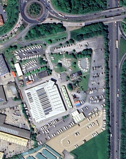
The Photograph shows just how well placed is Brownhills iat the juntion of the A1, the A17 and the A46, with access onto and off all of them in both directions.
With good weather forecast for the coming week, the first in July, we booked another favourite site, at Glyn Ceiriog in North Wales.
IN NORTH WALES JULY 2023
Newark, England to Ceiriog Valley Park, Glyn Ceiriog, North Wales 164 miles
The Ceiriog Valley lies south of Llangollen and east of Chirk, just off the A5. The valley winds west and south into the Berwyn Mountains providing access to a network of narrow lanes and remote villages. Settled on the riverside campsite in the valley between the village of Glyn Ceiriog and the hamlet of Pandy, we enjoyed some of the rides we wrote up back in 2014. They are all still there, some of them repeated more than once in the past 9 years:
Click: Fourteen Cycle Rides in the Welsh Borders
This is a very detailed account of each ride as well as the following links:
Maps of each of the 14 Cycle Rides
Map of All the Cycle Rides
Distance & Height Profiles for each Cycle Rides
68 labelled Photographs around the 14 Cycle Rides
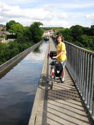
Enjoy the rides, particulary the one along the Llangollen Canal which includes TWO traverses of aqueducts - one across the mouth of the Ceiriog valley high above the River Ceiriog and one across Thomas Telford's famous Pontcysyllte Aqueduct over the River Dee in the Llangollen valley (Margaret giving way to an oncoming narrow boat).