Bulgaria 2023: Margaret's Travel Log
An Account of a Journey with a Motorhome and two Bicycles through Bulgaria in the Late Spring of 2023
Updated 5 February 2024
Continued from Margaret's Travel Log: Greece
Updated 5 February 2024
Continued from Margaret's Travel Log: Greece
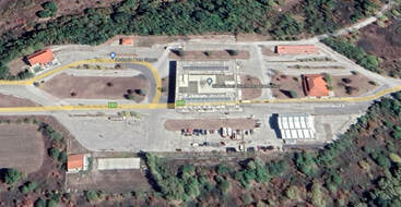 The Greek-Bulgaria border station at Ormenio
We entered Bulgaria from Greece through the Ormenio border crossing after driving 193 miles from Alexandros Camping at Nea Karvali. The Greek guard scrutinised our passports for the vital date that we entered the Schengen zone, then counted on his fingers to check the length of our stay (81 days) before duly stamping the passports with the exit date – no evidence of computerised records yet. Then through a no-man’s land and a disinfectant trough before entering non-Schengen (for now) Bulgaria. Here the guard stamped the passports, a customs official checked our garage, and I bought the electronic Vignette needed for all Bulgarian roads from a machine which charged 27 lev for one month (2 lev = 1 Euro). What a relief – no more counting the days for now.
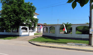 Entrance to Camping Sakar Hills
Just 15 familiar Bulgarian miles via Ljubimets to the village of Biser and the welcome sanctuary of Sakar Hills Camping, less than a mile off the main road, owned and run by the inimitable Jeffes family. Here we were expected and warmly greeted by managing son Matt.
Time to relax.
Time to relax.
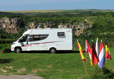
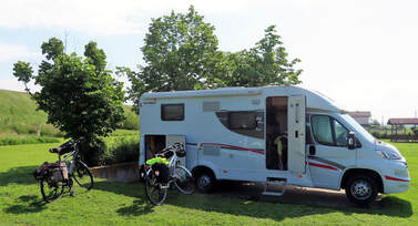 Our pitch at Camping Sakar Hills
At Camping Sakar Hills, Biser, Bulgaria May/June 2023
Changing Times
This is our 8th visit, starting in the early days of the campsite in summer 2008 when we were so enchanted by the rural peace, cycling opportunities and wealth of historical and archaeological sites that we stayed for 3 months! Matt’s parents Martin and Shirley, who became our very good friends, have now retired to Kent but life goes on in the oasis they created for campers of all types and nationalities, as welcome on two wheels as on four or more.
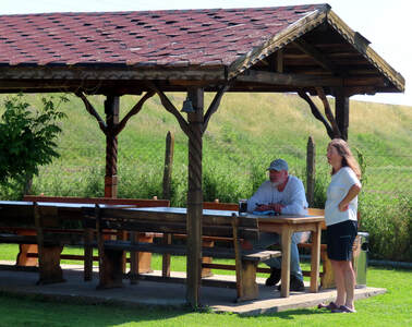 Matt and Margaret at the campsite's welcome and shady meeting place
An electrified rail line (Sofia to Istanbul) now runs right behind the camping field but road traffic is very light here. Even the main road that we cycle to Harmanli or Ljubimets is quieter, since it now parallels a new motorway (with an exit for each of these towns) carrying the trucks bound to/from Turkey. In Biser village, one-horse-power carts and donkey-drawn ploughs are still very much in use.
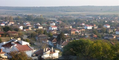 View of Biser Village
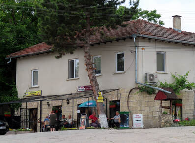
Though the Central Bar in the village has closed, the council office, library and junior school still function and the central square has no less than three automat machines offering hot and cold drinks and snacks. The single grocery shop, 5 minutes’ walk from the campsite, by the bridge over the river, was rebuilt and extended after the disastrous flood of 2012. It’s very handy for bread, milk, drinks, eggs and other basics and also has a covered veranda with seating, coffee machine and a communal cigarette lighter secured to the table by a length of string. Finally, we learnt that a new bistro opened in the village soon after we left.
Click: More Images of Sakar Hills Camping
Click: More Images of Sakar Hills Camping
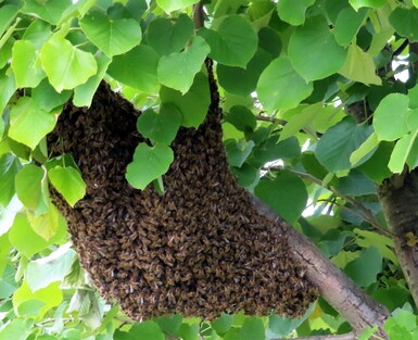 Bees in the Trees
Birds, Bees and All Things Bright and Beautiful
On our arrival Matt warned us that local honey bees had recently been swarming “but don’t worry, they’re very docile, I only got stung twice yesterday”! Later the same day we noticed an ominous swarm in the tree right behind our pitch. The neighbouring beekeeper, who has an orderly row of 15 hives in his productive vegetable garden, was alerted and soon appeared with his wife, both impressively dressed in colourful helmets and overalls. We watched from a safe distance as the bees were smoked into a conical container and carried off home. Over the next few days, two more swarms gathered in the camp trees, duly collected by another apiarist from over the road. We do appreciate honey but the buzzing of the bees as they gathered before swarming had us hiding inside, windows firmly closed! Then as the weather turned cooler with some rain showers, they seemed happy to stay home.
On our arrival Matt warned us that local honey bees had recently been swarming “but don’t worry, they’re very docile, I only got stung twice yesterday”! Later the same day we noticed an ominous swarm in the tree right behind our pitch. The neighbouring beekeeper, who has an orderly row of 15 hives in his productive vegetable garden, was alerted and soon appeared with his wife, both impressively dressed in colourful helmets and overalls. We watched from a safe distance as the bees were smoked into a conical container and carried off home. Over the next few days, two more swarms gathered in the camp trees, duly collected by another apiarist from over the road. We do appreciate honey but the buzzing of the bees as they gathered before swarming had us hiding inside, windows firmly closed! Then as the weather turned cooler with some rain showers, they seemed happy to stay home.
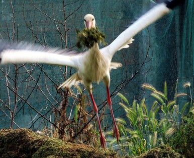 Matt's grass cuttings make a fine lining for a large nest
There is plenty of bird life around, with sparrows, starlings, swallows, house martins, crested larks and delightful nesting storks. But I spotted one species that I’ve only seen once before (in Sardinia): an exotic rainbow-coloured Bee Eater, no less, seen twice overflying the hives! Matt said that some Dutch birdwatchers had stayed recently because Bee Eaters had been reported, but they failed to find one and had moved on to the Black Sea coast. I felt quite privileged.
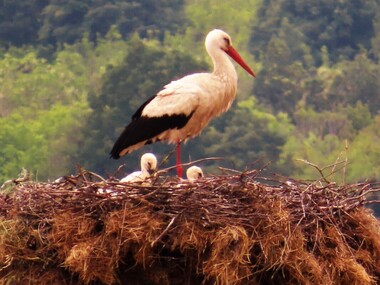 Mum with two of her triplets
Storks are a lovely feature in all the local villages, returning in spring to their untidy nests on lamp posts and chimneys to raise a brood. One pair, nesting in full view of the campsite, were taking turns to guard the eggs when we arrived, greeting each other with beak-clacking as they changed shift. Now there are also three small but rapidly growing chicks to feed, peering over the edge of their home in anticipation of the next meal or plucking up courage for their first flight.
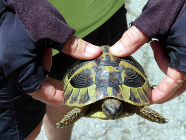 Margaret rescues yet another errant tortoise
Other wildlife includes tortoises, who sadly think their armour plating will protect them from every foe and so have no road sense at all. They’re surprisingly heavy creatures when picked up to rescue. There are also colourful butterflies and assorted insects to pollinate the brilliant red poppies and various wildflowers, plantations of sunflowers, wheat, tobacco and vines, and orchards of apples and stone fruits – though with a Balkan rather than Mediterranean climate, we miss the olive and citrus groves of Greece.
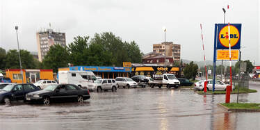 Lidl's flood as it receded
A Lidl Flooding
To restock our food supplies after two weeks at Sakar Hills we drove into Harmanli (8 miles each way) to the nearest Lidl supermarket, with a generous car park. It rained very lightly as I went into the store, leaving Barry with coffee and a book. After a while he came across to join me, saying it had stopped raining. Suddenly thunder and lightning shook the building, the lights went off, rain hammered down and a glance outside showed the car park and adjacent dual carriageway under a rising stream of water that covered car wheels! Along with other shoppers, we sheltered in the foyer for a good hour until some valiant workmen arrived to lift blocked drain covers along the road. The floodwater gradually subsided and we paddled across to the motorhome, happily postponing a walk to the bank’s ATM.
But the story didn’t end there! Back at the waterlogged campsite, our motorhome got bogged down on the grass (sorry, Matt) and we remained stuck in a rut for 2 days until the ground dried out!
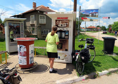 Margaret delivers two coffees in the hill village of Malko Gradiste
Cycling the Surrounding Hills and Villages
A major attraction for us is riding the network of quiet lanes linking the local villages and climbing into the hills, observing life in this rural south-east corner of Bulgaria. Although every ride must go out or back via either Harmanli or Ljubimets (each about 10 km from Biser), the road between them carries much less traffic, especially trucks, since the opening of a parallel motorway. There are cafés in both these towns: a particular favourite in the square in Ljubimets sells crème caramel, trifles and ices as well as the best cappuccino we found in Bulgaria! The villages usually have a basic shop with cold soft drinks, or perhaps a vending machine with coffee, hot chocolate and tea if you can decipher Cyrillic and have a few coins (change given!) We always carry snacks and biscuits.
A major attraction for us is riding the network of quiet lanes linking the local villages and climbing into the hills, observing life in this rural south-east corner of Bulgaria. Although every ride must go out or back via either Harmanli or Ljubimets (each about 10 km from Biser), the road between them carries much less traffic, especially trucks, since the opening of a parallel motorway. There are cafés in both these towns: a particular favourite in the square in Ljubimets sells crème caramel, trifles and ices as well as the best cappuccino we found in Bulgaria! The villages usually have a basic shop with cold soft drinks, or perhaps a vending machine with coffee, hot chocolate and tea if you can decipher Cyrillic and have a few coins (change given!) We always carry snacks and biscuits.
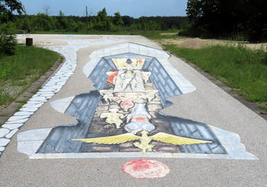 Optical illusion on the road to the Mezek Tomb
We completed nine rides totalling 450 km, many of them old favourites, circling through the villages of Cerna Mogila (Black Hill), Lozen, Jerusalimovo, Kolarovo (where we came across a Wine Festival), Balgarin, Izvorovo (its Roman Museum sadly closed down), Balgarska Polyana, Malko Gradiste, Siva Reka and Mezek. The superb 4th century BC Thracian tomb at Mezek was closed (though we have visited it before) but the medieval fortress, a stiff 1.6 km climb above the village, was very much open with a school party enjoying their open-air history lesson. The castle was partly restored in the early 20th century after the Ottomans had taken a lot of the stones to build their barracks in Svilengrad, 10 miles away on the Turkish border.
We asked Matt (who likes dogs) why the animals love to chase cyclists. He said that in our hi-viz colours we look like squeaky toys on wheels, so that's us branded!
Click: More Images of Cycling in Bulgaria
We asked Matt (who likes dogs) why the animals love to chase cyclists. He said that in our hi-viz colours we look like squeaky toys on wheels, so that's us branded!
Click: More Images of Cycling in Bulgaria
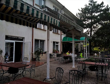 Evening meal on the terrace of the Paradise Hotel in Madzharovo
A Night in Madzharovo (59 km out, 56 km back)
We did plan a four-day ride in the Rhodope Mountains, with a night in each of Madzharovo, Krumovgrad and Ivailovgrad, reversing part of an 8-day route we had cycled in 2019. The first day went well, out via Harmanli and Ivanovo, then a long climb on a newly surfaced and empty road before dropping for the last 10 km into Madzharovo. On our third visit to the only hotel in town, the Rai (meaning Paradise), we found it still run by the same friendly old couple who speak only Bulgarian, accept only cash (it’s been 80 Lei for B&B for years!) and have no other guests! Our bikes were safely stowed in a garage, I raided the village shop and we dined at the hotel on chicken with mushroom sauce, bread and chips, finishing with cake, all prepared and served by our hosts.
Click: More Images of Madzharovo
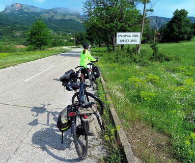 Leaving Madzharovo and entering border country
Next morning the weather forecast promised serious rain and thunderstorms in the mountains. Over an interesting breakfast of thick yogurt, cherries and what I remember from childhood as Eggy Bread, along with large pots of both tea and coffee, we were anxiously warned about conditions. We finally and reluctantly had to agree that it would be dangerous to venture higher to Krumovgrad. On leaving the town, we paused at the Pantheon and memorial park to those lost in the Turkish-Balkan War of 1913/14, remembering that this is very much a frontier zone
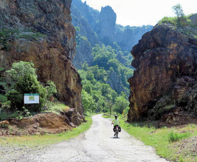 Leaving the volcanic crater in which Madzharovo was built
So we returned to Biser by an alternative and more scenic route, climbing through the gorge above the river Arda, meeting twitchers from the Eco-Centre who were searching for vultures. After the village of Borislavtsi we eventually dropped to Malko Gradiste, where we were overtaken by the rain, riding on through a heavy downpour to Lozen and Ljubimets, to dry out in our favourite café over chicken soup, bread, coffee and dessert. It was then a race along the main road to Biser, keeping ahead of more threatening black clouds rolling low over the hills. By the time we reached camp again we were dry: slightly disappointed, but it had been a wise decision.
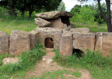 The dolmen on the road to Hylabovo
Biser to Camping Gemmagos, Bojanovo, Bulgaria 63 miles
Leaving via Harmanli, then rd 76 towards Topolovgrad, we parked after 30 miles before the village of Hylabovo for the short walk down to a prehistoric dolmen (the largest found in Bulgaria), its EU-funded signpost and footpath now neglected and overgrown. The impressive stone chambers dating from the early Iron Age contained grave goods and human remains until they were excavated some 50 years ago.
Click: More Images of the Dolmen
Joining the busier rd 7 (from the Turkish border) after Topolovgrad, we bypassed the next town, Elhovo, then turned off right for Bojanovo about 20 miles before Jambol. There is a small and simple campsite just a mile along the road into the village, behind the house of the English owners, Guy and Janet. As the only guests, it made a peaceful stopover before our visit to the ancient site of Kabile, near Jambol, next day.
Joining the busier rd 7 (from the Turkish border) after Topolovgrad, we bypassed the next town, Elhovo, then turned off right for Bojanovo about 20 miles before Jambol. There is a small and simple campsite just a mile along the road into the village, behind the house of the English owners, Guy and Janet. As the only guests, it made a peaceful stopover before our visit to the ancient site of Kabile, near Jambol, next day.
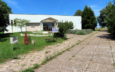 The Kabile museum
The Ancient Thracian/Roman City of Kabile
This extensive archaeological site with an excellent modern museum lies about 5 miles north of Jambol, near the present-day town of Kabile. It’s most easily accessed from the A1 (Sofia-Burgas) motorway. Take the exit for Kabile, where there is a huge parking area and a brown sign pointing down a lane to “Thracian and Ancient City Kabile: 800 m”. Unsure about leaving the motorhome alongside the international trucks, we drove along the lane to the site, which had adequate parking space. Entry to the archaeological remains was free, while the museum cost only 6 lev (about 3 Euros) each. We were the only visitors on this sunny Tuesday morning.
This extensive archaeological site with an excellent modern museum lies about 5 miles north of Jambol, near the present-day town of Kabile. It’s most easily accessed from the A1 (Sofia-Burgas) motorway. Take the exit for Kabile, where there is a huge parking area and a brown sign pointing down a lane to “Thracian and Ancient City Kabile: 800 m”. Unsure about leaving the motorhome alongside the international trucks, we drove along the lane to the site, which had adequate parking space. Entry to the archaeological remains was free, while the museum cost only 6 lev (about 3 Euros) each. We were the only visitors on this sunny Tuesday morning.
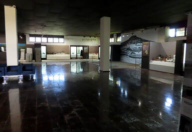 The entrance hall of the Kabile Museum
The newly built museum was cool, spacious and very well presented. As the friendly guard spoke only Bulgarian, we were left in peace to study the many exhibits labelled in both English and Bulgarian. The finds, including a wealth of pottery, coins and votive figures (especially Thracian horses and horsemen), were arranged chronologically: from Palaeolithic through Bronze and Iron Ages, Thracian to Greek, then Roman and early Christian until the city was destroyed by Goths and Avars in the 6th century AD. In Thracian times it was already a city important enough to mint its own coins, on an important trade route.
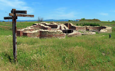 A Roman building in the ancient city of Kabile
Extremely impressed, we went on to explore the outdoor remains, scattered over a wide area and linked by grassy paths, all well excavated as they were not overbuilt in a subsequent era. Evidence of a Thracian sanctuary was found on ‘Rabbits Hill’, overlooking the ruins of Roman baths, military camp, city walls, east gate and an early Christian basilica. We were very pleased we made the detour – and glad of the waiting motorhome, as there was no café of any kind.
Click: More Images of Kabile
Researching the site, we learnt that the first excavations in 1912 were directed by the notorious Bogdan Filov who became Professor of Archaeology at Sofia. Unfortunately he entered politics as Bulgaria's wartime Prime Minister and was ultimately executed by the Russians in 1945. Follow the link for his story: making history was more dangerous than teaching it.
Bojanovo to Camping Oazis, Nr Sliven, Bulgaria 55 miles
After the morning at Ancient Kabile we continued along A1 to the next exit (rd 53) for Sliven, and through this busy city in Northern Thrace. Another 16 km northeast, along the road to Gradec, we found the sign leading down a track to a new campsite, only set up in 2022 in the foothills of the Balkans. It had rough grass pitches and clean WC/shower facilities in a cabin. We didn’t enjoy a mediocre meal in the outdoor restaurant (the inevitable shopska salad, rubbery chicken breast and cheesy chips).
After the morning at Ancient Kabile we continued along A1 to the next exit (rd 53) for Sliven, and through this busy city in Northern Thrace. Another 16 km northeast, along the road to Gradec, we found the sign leading down a track to a new campsite, only set up in 2022 in the foothills of the Balkans. It had rough grass pitches and clean WC/shower facilities in a cabin. We didn’t enjoy a mediocre meal in the outdoor restaurant (the inevitable shopska salad, rubbery chicken breast and cheesy chips).
Sliven to Camping Kapinovski, Kapinovski Monastery, Bulgaria 129 miles (via Shipka Pass)
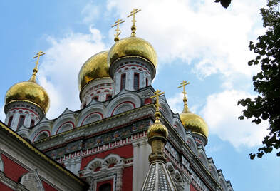
Back to Sliven and west on rd 6 to the village of Gurkovo, aiming to take rd 55 over the Pass of the Republic at 700 metres. However, we rapidly changed direction on seeing the endless procession of trucks in both directions on a seriously busy transport route. Returning to rd 6, we continued to the tourist town of Kazanlak at the heart of the Valley of Roses to take a longer route over the Shipka Pass, which at least bans HGVs. There is even a cycle path as far as Shipka village, where the sunlit onion domes of the church commemorate the Russo-Bulgarian victory over the Ottomans in 1877-78. Then a 13-km serpentine climb leads to the summit, the Shipka Pass at 1190 metres (3,927 ft), with tourist stalls, a café and a parking area for the many school trip buses. We remembered a night at the now-closed hotel while cycling over the pass on our way from England to Istanbul in 1989. Riding up, we met a group of Russian cyclists with their minder.
Back to Sliven and west on rd 6 to the village of Gurkovo, aiming to take rd 55 over the Pass of the Republic at 700 metres. However, we rapidly changed direction on seeing the endless procession of trucks in both directions on a seriously busy transport route. Returning to rd 6, we continued to the tourist town of Kazanlak at the heart of the Valley of Roses to take a longer route over the Shipka Pass, which at least bans HGVs. There is even a cycle path as far as Shipka village, where the sunlit onion domes of the church commemorate the Russo-Bulgarian victory over the Ottomans in 1877-78. Then a 13-km serpentine climb leads to the summit, the Shipka Pass at 1190 metres (3,927 ft), with tourist stalls, a café and a parking area for the many school trip buses. We remembered a night at the now-closed hotel while cycling over the pass on our way from England to Istanbul in 1989. Riding up, we met a group of Russian cyclists with their minder.
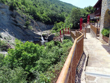
All downhill from here, eventually taking the new Gabrovo bypass that goes through a tunnel and rejoins rd 5 before Dryanovo (whose simple campsite and Orthodox Monastery we know of old). For a new experience, we continued to Debelec and took a minor road for the final 16 km through Velcevo village to the end of the road at Kapinovski, site of an old monastery and a new camping resort with surprising features. Presumably attracting visitors from Veliko Tarnovo, the large wooded campsite has ultra-modern facilities, two swimming pools, playground with trampolines, bars and a restaurant overlooking a stream and waterfall with a rock pool for hardy swimmers. Remarkable in Bulgaria!
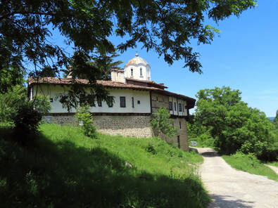
At Camping Kapinovski: A Walk and a 22-km Cycle Ride visiting 2 Orthodox Monasteries
A quiet sunny morning walking round the site, taking photographs and following the path to the highly restored Kapinovski Monastery and Church of St Nikolaus the Wonderworker. The church dating from 1272was impressive, painted with frescoes inside and out, and set in flowery gardens with resident cats. It was freely open to visit with a booth selling candles and souvenirs to the faithful.
A quiet sunny morning walking round the site, taking photographs and following the path to the highly restored Kapinovski Monastery and Church of St Nikolaus the Wonderworker. The church dating from 1272was impressive, painted with frescoes inside and out, and set in flowery gardens with resident cats. It was freely open to visit with a booth selling candles and souvenirs to the faithful.
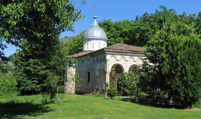
Later we cycled back to Velcevo village (6 km each way) to find it deserted, the only shop/bar closed, but at least a drinks vending machine worked. On the return ride we paused to visit the smaller Plakovo Monastery and Church of Saint Ilia (the prophet Elijah, a Greek favourite), signed just 50 metres off the road. Built in 1280, it was guarded by a man with 7 cats and a dog, thankfully all friendly! He unlocked the simple church for us, spoke a little English and asked only some small change in the donations box. Cycling on past the campsite alongside the stream, we soon found the lane ended after 5 km, where it was blocked at the entrance to a dammed reservoir.
Kapinovski to Camping Koukery, Koshov, Bulgaria 70 miles
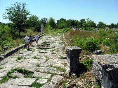
We retraced the 16 km via Velcevo to Debelec village to join E85/rd 5, to and through the historical city of Veliko Tarnovo: a route made easier by 2 short tunnels under the old town of Bulgaria’s original capital. Rd 5 continues to Ruse, where the Friendship Bridge crosses the Danube into Romania. After Veliko Tarnovo we passed the left turn signed to the Roman site of Nikopolis ad Istrum but, with no parking and a very narrow lane, it was inaccessible. We had been lucky to visit the site in 2009 by Landrover, thanks to Martin Jeffes of Sakar Hills.
We retraced the 16 km via Velcevo to Debelec village to join E85/rd 5, to and through the historical city of Veliko Tarnovo: a route made easier by 2 short tunnels under the old town of Bulgaria’s original capital. Rd 5 continues to Ruse, where the Friendship Bridge crosses the Danube into Romania. After Veliko Tarnovo we passed the left turn signed to the Roman site of Nikopolis ad Istrum but, with no parking and a very narrow lane, it was inaccessible. We had been lucky to visit the site in 2009 by Landrover, thanks to Martin Jeffes of Sakar Hills.
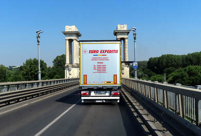
On we drove along rd 5/E85, busy with trucks on the transit route to/from Romania: a totally inadequate 2-lane road with no overtaking and speed bumps in the villages it traversed, long overdue for a dual carriageway or motorway. After Bjala, with its well-advertised roundabout, we took the exit for Dve Mogili (meaning Two Hills). The narrow hilly lane led us for 3 km to the cobbled high street of a large gipsy village, where we turned north on a better road for 10 km to the right turn to Koshov village. Before the descent to the village, a signed left turn for Camping Koukery took us along a bumpy 300-metre track to the entrance to another new campsite. We were greeted by English-and German-speaking Katerina, who runs the site along with her dad, whilst living about 20 miles away in Ruse.
We seemed to have the well equipped site, with its amazing views over the gorge and Koshov village, to ourselves but it soon filled up with one French and several German vans on their way home. The ‘short walk to the shop’ turned out to be almost 1 km each way, with a stiff climb back, so we postponed it till tomorrow!
At Camping Koukery, Koshov: Cycling 26 km to the Ivanovo Rock Churches
First we cycled down to Koshov village shop for bread, exploring the crumbling streets at the bottom of the gorge before climbing steeply back past the camping to the main road. Then it was just 3 km along to the turning for Ivanovo, a larger village with 2 shops, a library (closed) and cafe (also closed), though we did manage to find coffee at a machine. It’s thirsty riding in mid-June.
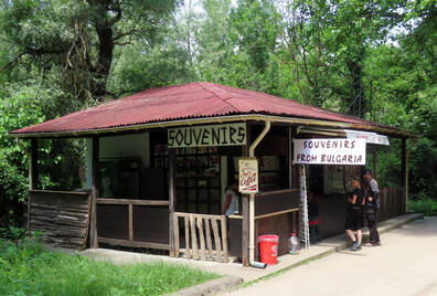
A narrow lane led off, right, for 4 km downhill to the valley of the Roussenski Lom River and the famous Rock Churches. The road was being widened, with some roadworks and a rough section, having been discovered by tourist buses. After passing a new restaurant (closed) we came to a car park with stalls selling souvenirs, postcards, rose-flavoured lukumi (known to us as Turkish Delight, but not to Greeks and Bulgarians!) and, thankfully, cold drinks. Two craftsmen were selling their wares - an icon-painter and a woodcarver – who spoke German and accepted Euros. We pushed the bikes along a footpath to the foot of the ascent to the churches and monasteries carved into the rock, but realised we couldn’t safely leave the bicycles, or climb the hazardous track in smooth cycling shoes. The few tourists who were up for it (literally) carried on, to pay the entrance fee at the top. We were content to cycle back, with an ice cream break in Ivanovo.
Koshov, Bulgaria to Camping Oude Wilg, Carta, Romania 249 miles
A 22-mile drive along the main road via Ivanovo to Ruse and the ironically-named Friendship Bridge over the Far-from-blue Danube, linking Bulgaria with Romania. Despite the rumours and long lines of waiting trucks, there was little delay for private vehicles. We filled with diesel and paid the bridge toll of €6 on the Bulgarian side and edged our way for 2.25 km across the bi-level road and rail bridge, built by Russia in 1952. On the far side we bought a 7-day Romanian vignette for €8.
A 22-mile drive along the main road via Ivanovo to Ruse and the ironically-named Friendship Bridge over the Far-from-blue Danube, linking Bulgaria with Romania. Despite the rumours and long lines of waiting trucks, there was little delay for private vehicles. We filled with diesel and paid the bridge toll of €6 on the Bulgarian side and edged our way for 2.25 km across the bi-level road and rail bridge, built by Russia in 1952. On the far side we bought a 7-day Romanian vignette for €8.
 On entering Romania Paddington, once intended for Orphans in 1990, takes cover in his bed
A new TIR route past Giurgiu soon joined the E85 dual carriageway towards Bucharest. After weeks of deciphering Slavic Bulgarian in Cyrillic script, it was good to see signs we could easily read and perhaps understand, the Romanian language being Latin-based (eg paine for bread). We passed two busy Sunday markets with roadside stalls selling fruit and live chickens before joining the busy Centura ring road at 60 miles. Another 10 miles towards Pitesti, then onto the A1, a 4-lane motorway ending at that industrial city. We broke for lunch on a service station by Pitesti at 133 miles, then took the E81 signed Rimnicu Valcea/Sibiu.
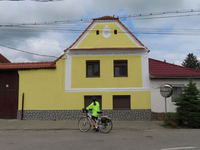
The narrow road climbed and twisted up to 540 m at Moraresti, dropped to 350 m, then rose to 450 m and down again to 225 m at Rimnicu Valcea where heavy rain fell, in the foothills of the southern Carpathians. Here we crossed the Olt River, then closely followed its river valley alongside the railway towards Sibiu. There were many new hotels, restaurants and truck stops along the scenic route. Meeting the busy road 1 we turned right towards Brasov, then (2 km past the Transfagaras Route roundabout) took a left turn for the village of Carta, the Fagaras Mountains looming snow-flecked above.
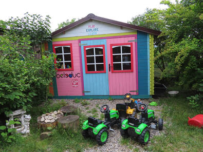
Along the lane, over the railway line and left in the village to the delightful Old Willowtree (Oude Wilg) campsite, tucked behind the house of its owners, our old friends Manette and Tudor. Manette (who is Dutch) welcomed us warmly and her Romanian husband, a gentle artist, is looking forward to the day he can retire from teaching at the village school. We recommended it! Manette was helpful as ever, changing Euros for Romanian Lei and offering a wash & dry laundry service.
Continued at Margaret's Travel Log: Romania